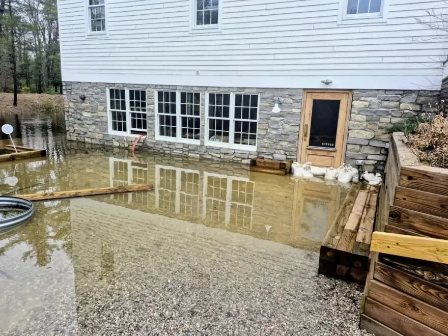
Clear Creek flows into Golden from the west and emerges from Clear Creek Canyon at the city. That geography makes current maps useful for planning, while the actual cleanup still depends on where water entered and what it touched inside a particular building.
Key takeaways
- Use current flood maps for land risk context and indoor readings for cleanup boundaries.
- Runoff can collect away from a visible creek channel.
- Keep people out of standing water when electricity or structural damage may be involved.
- Treat outdoor storm water as contaminated and inspect concealed porous materials.
- Document the entry route, removed materials, cleaning, and final moisture readings.
Clear Creek is only one part of the local flood picture
Clear Creek passes through the community after leaving its canyon. A building near the corridor may have an obvious water feature to consider, yet floodplains can also include runoff collection areas away from a visible waterway.
That means a wet lower room should not be attributed to the creek from location alone. Water can enter at a doorway, window well, wall opening, or low foundation point.
It can also come from plumbing. The visible route and conditions during the event help distinguish those sources.
A storm flood cleanup evaluation traces the entry path, checks the water condition, and maps affected material. The response is based on the building evidence rather than a broad neighborhood assumption.
- Inspect door thresholds and low openings from a safe area.
- Note soil, debris, or staining that marks an outdoor route.
- Check plumbing fixtures and supply controls for a separate indoor source.
- Record the rooms and contents touched by the water.
Maps and elevation records answer planning questions
The city maps areas most at risk of flooding and applies building regulations in flood prone areas. It also participates in the FEMA Community Rating System.
These programs help owners evaluate land and building exposure before an event.
Flood Insurance Rate Maps identify mapped risk. An elevation certificate helps evaluate a building relative to base flood elevation.
Neither document replaces an inspection of present wet materials after water enters.
Maps can change, and a property record should be checked in its current form. An owner planning future work can keep map information and elevation records with the property file, separate from the room by room restoration record.
A map boundary also cannot describe the condition of finishes, contents, or utilities after a particular storm. Two spaces in the same building may have very different moisture patterns because water follows openings and low points.
The cleanup sketch should therefore mark actual rooms and materials rather than repeat a parcel level designation.
- Confirm that the map version is current.
- Keep an available elevation certificate with building records.
- Use maps to discuss future risk and regulations.
- Use direct moisture readings to set the present cleanup boundary.
Safe entry comes before basement extraction
Not every local home has a basement, but a property with a wet lower level needs special attention to safe access. Stairs may be slick, finishes may be loose, and water may have reached electrical equipment.
Occupants should not descend into standing water when electrical status is uncertain. Utilities and power controls should be handled from a safe location by someone qualified for the condition.
Exterior flow should also be observed so an open door does not admit more water.
When access is safe, basement flooding cleanup begins with source documentation and controlled extraction. Removing water in zones makes changing material conditions easier to observe.
- Keep access closed when electrical safety is unresolved.
- Check the stability of stairs and overhead finishes.
- Move only dry contents reachable without crossing water.
- Photograph the water edge before extraction changes it.
Outdoor water changes what can remain
Storm water can carry soil and contaminants from pavement and ground surfaces. Porous finishes that absorb that water may not be suitable for drying in place.
Carpet pad, saturated drywall, insulation, and similar materials require careful evaluation.
Cleanable hard materials may remain after debris removal, washing, treatment, and drying. Controlled openings can expose wall plates, framing, and floor edges without extending removal beyond the measured and affected area.
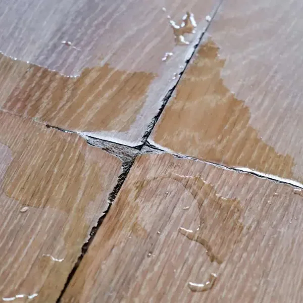
Water can wick above a visible stain and travel beneath flooring. Moisture mapping should therefore extend into adjacent rooms, closets, and the opposite side of a shared wall.
Local flood defenses do not remove property level risk
Golden invests in dams and drainage systems and preserves natural floodplains so they can absorb excess water. Those actions are part of community risk reduction, but they do not make every structure immune from runoff or plumbing related water damage.
A preserved floodplain can serve an important landscape function while an individual owner still needs a response plan. The plan should cover safe exits, shutoff locations, document storage, and the people responsible for checking an unoccupied property.
USGS maintains a Clear Creek monitoring location at the city. Monitoring and maps inform awareness.
Direct observation at the building determines whether a cleanup is needed.
- Store key records where water is less likely to reach them.
- Identify indoor water shutoffs before an emergency.
- Keep exits and lower level stairs clear.
- Review the observed entry route after each event.
A complete drying record supports later decisions
Extraction removes liquid water, while drying addresses moisture retained in framing, concrete, subfloor, and finishes that can safely remain. Equipment is adjusted from readings as the wet boundary contracts.
The record should connect photographs, the source description, the material inventory, cleaning steps, equipment placement, and final readings. An owner can then separate restoration facts from broader map and insurance questions.
The Golden water damage service overview provides related options when storm entry affects ceilings, walls, or structural materials beyond the lower room. Reconstruction should follow source control, cleaning, and confirmed drying.
- Label photographs by room and viewpoint.
- List material removed because of contamination or damage.
- Track readings against a dry reference.
- Keep flood map documents separate from the drying log.
Questions
Does being outside a mapped flood area rule out storm water damage?
No. Runoff can collect away from a visible waterway, and maps cannot predict every property level entry route. Current building conditions still need direct inspection.
What does an elevation certificate help explain?
It helps evaluate a building relative to base flood elevation. It does not show which indoor materials became wet during a specific event.
Can basement carpet be dried after outdoor water enters?
Outdoor water may carry contamination, and carpet pad or other porous layers can trap it. The decision depends on contact, condition, and whether every affected layer can be safely cleaned.
Why are adjacent rooms checked?
Water can move beneath flooring and through wall bottoms beyond the visible puddle. Moisture readings establish the full boundary before drying equipment is placed.
Do community drainage projects prevent every building loss?
No. Dams, drainage systems, and preserved floodplains reduce community risk, but individual buildings can still experience runoff entry or indoor plumbing failures.